This is a great place with possibilities for hiking, swimming, XC skiing, and even a little Jeeping.
Here’s a description from Waterville Valley Athletics and Improvement Association (quite a name!):
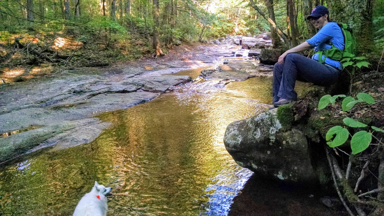
This is an EASY trail that leads to a popular swimming hole just 40 minutes from Route 49. It also offers a long but gradual route up to Sandwich Dome[3980 ft.]
The trail begins at the southwestern end of the Smarts Brook parking lot, on your left as you head out of Waterville Valley on Route 49, just after Upper Mad River Road crosses the river on your right. From the parking lot, cross the brook on the road. On the other side of the brook, the trail turns left and enters the woods on some log steps, joining with an old roadbed. Soon a X-C ski trail with a blue marker bears to the left. Stay right and follow the trail through a stand of hemlocks until you join with a logging road. Here, the Tri-Town Trail continues straight ahead. To remain on the Smarts Brook Trail, turn left at the intersection on the logging road. After a while, the brook will come alongside the roadbed on your left; and soon after that, you will come to a forest protection area, where there is a popular swimming hole [40 min.], and therefore camping and fires are prohibited. The upper trailhead of the Tri-Town trail enters 10 minutes up from the pool. The Yellow Jacket Trail diverges left shortly after that on a wooden bridge crossing over Smart’s Brook. Continuing up the Smarts Brook Trail, you soon see a beaver pond on your right. After this, the logging road diminishes and becomes more of a trail as it continues gradually up the valley, past several big boulders, staying alongside the brook for most of its length, until it finally connects with the Sandwich Mountain Trail near the summit.
Here is a great set of pictures of the place in the winter, and here is a great description by the person who took them of a nice ski loop there. Can’t wait to ski there! And for a full description of the ski trails available around here, go here.
As for Jeeping — just before the Smarts Brook parking lot, there’s a logging road entrance that’s a national forest route with no markings, so it appears to be Jeep-able. Haven’t tried it yet, though. The road is definitely used for hiking (it’s part of several of the hikes/skis above), but it looks like it’s driven on fairly often.
We had a great trip with the dogs here at the very end of summer.